Hal Jespersen’s Civil War Maps
 |
| Click here to visit my new mapping site, www.cwmaps.com, for 200+ free maps and custom cartography services |
Custom Maps
I have recently been doing maps for commercial projects that are much more suitable for black-and-white printing than my free Wikipedia maps. I would be happy to work with you on any custom maps your project might need. Since I am doing this is a retirement hobby, my rates are quite reasonable. Please visit my new website for details: www.cwmaps.com.
Free Wikipedia Maps and Images
I have created over 200 maps I have created for Wikipedia American Civil War battle articles, usually articles I wrote myself. They are available to others under the Creative Commons Attribution 3.0 license, which means that if you use them—either modified or unmodified—you must abide by the terms of that license and attribute the image to "Map by Hal Jespersen, www.cwmaps.com". These maps are now available at my new website, www.cwmaps.com (under the FREE MAPS tab).
The following images that drew for Wikipedia are not strictly Civil War maps. They are in the public domain and can be used for any purpose without acknowledgment.
Map or Image Name |
Source |
Graphic |
Notes |
| Historic Triangle, Virginia | Historic Triangle article | ||
| Military crest | article | ||
| Virginia Capital Trail | article |
Photoshop Images
I occasionally create composite images of Civil War photographs for Wikipedia articles. The table below has the Photoshop PSD files. In these portraits, the figure(s) and background are in separate layers. (some of these PSD files are pretty large.)
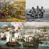 |
American Civil War Montage (created for main Wikipedia article, since replaced by ungrateful editors) |
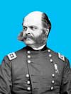 |
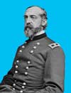
Ambrose E. Burnside |
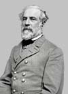 |
Robert E. Lee |
 |
George G. Meade |
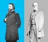 |
John Pope and Robert E. Lee (standing) |