2014 Civil War Travelogues — Overland Campaign
Welcome to my 2014 travelogue pages, commemorating the fourth year of the Civil War Sesquicentennial! This report covers my May trip to Virginia to follow Grant's Overland Campaign with Gordon Rhea and BGES. To see the entire list of my 2014 trips, go here.
This is a relatively lengthy report, so here are some links to jump to each day:
- Fredericksburg
- The Wilderness
- Spotsylvania Court House
- North Anna
- Cold Harbor
- North Anna, Bermuda Hundred, and Cold Harbor
- Richmond
| Here is a reminder about the reason I write these pages the way I do. They record my experiences and impressions of Civil War trips primarily for my future use. Thus, they sometimes make assumptions about things I already know and focus on insights that I receive. They are not general-purpose descriptions for people unfamiliar with the Civil War, although I do link to various Wikipedia articles throughout. Apologies about the quality of interior photographs—I don't take fancy cameras with big flashes to these events. If you would like to be notified of new travelogues, connect to me via Facebook. |
Sunday, May 18 — To Virginia
Heading out to Richmond (via Newark). The tour starts Monday evening in Fredericksburg. I am not sure how much time I will have available to update this travelogue while I'm on the road, but will do what I can. I expect to finish the entire effort on May 26, so be sure to check back then.
Monday, May 19 — Fredericksburg
I flew to Richmond on Sunday and checked into the Hyatt Place airport hotel that night. In the morning I had a little bit of time to fill before I left for Fredericksburg, so I decided to visit Fort Harrison. I had been here a couple of years before, but I decided I wanted to see it again because in the meantime I did maps for a book by Doug Crenshaw, Fort Harrison and the Battle of Chaffin's Farm. It was interesting to translate the topographic information that I usually use into actual terrain. If it were not for the shaded elevation maps I created, I might have had a very difficult time interpreting the battle, because the avenues of approach for both the Union attack and the Confederate counterattack are covered by dense woods, making it difficult to see the ground (which was almost completely open in 1864).

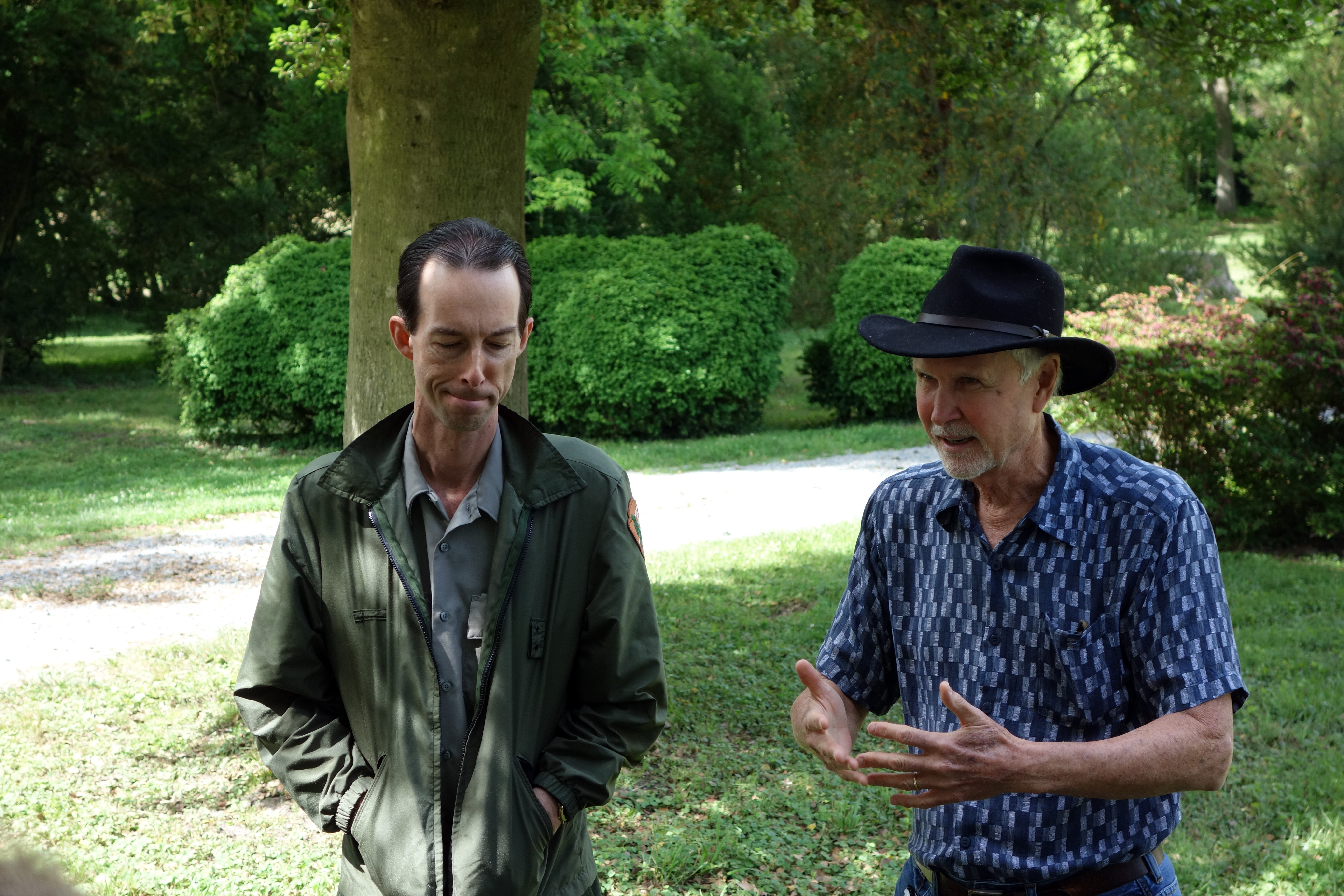
Fredericksburg is about an hour's drive north and I arrived there at the NPS visitor center to meet Don Pfanz, who had just retired from 32 years in the Park Service. Don was my main historian contact in doing the maps for the latest book from the Emerging Civil War series, No Turning Back: A Guide to the 1864 Overland Campaign, from the Wilderness to Cold Harbor, May 4 - June 13, 1864. This book required a number of very intricate driving tour maps, so when he handed me my autographed copy, I was quite pleased at the quality of the printing and how good the maps looked. Don treated me to a nice lunch and then we went out exploring. I told him that I had visited the town and battlefield a few times already, so I hoped he had some things to show me that would not involve a lot of repetition (i.e., a waste of his time). I was surprised and delighted to find that we walked to a number of places that I had not seen before, making it a very valuable experience. I regret to say that I did not take my usual detailed notes while we walked and talked one-on-one, so I probably have forgotten some details.
We drove around a bit on some of the fancier streets, and then started walking from the upper pontoon crossing, where the 7th Michigan crossed the Rappahannock under fire. We followed their progress through the town and Don pointed out a number of historic houses and combat actions along the way. We visited the Confederate Cemetery and searched out some generals' graves: Abner Perrin, Carter Stevenson, Henry Sibley (which is marked by a modest tombstone exactly like a regular soldier's), Dabney Maury, and Daniel Ruggles. None of these were particularly picture worthy. We also found the graves of two soldiers who were killed on May 2, 1862, when they were shot by friendly fire along with Stonewall Jackson: James Boswell and William Cunliffe; the latter had a more impressive monument than most in the cemetery.


We passed over Kenmore Street, which has covered over the famous canal ditch that caused the Union soldiers so much difficulty—I had not known its exact location previously. We stopped at the impressive house called Federal Hill. Pretty soon we reached Marye's Heights. This was an impressive walk for me because no tour I have taken has ever followed the Union soldiers up the slope, they just looked down from the top—and you really can't see very much from up there anyway. I guess buses can't go that way, but there were no obstacles to pedestrians. Of course, the terrain is dramatically different, entirely built up, but you can use your imagination to get a good sense of how the soldiers progressed, and the very minor slope that provided some defilade against the enemy fire. We walked up and down the sunken road and Don identified the portions of the famous stone wall that were original. I was quite surprised to learn that up until about 20 years ago, the sunken road was an active street, and the NPS folks had to deal with truck traffic rumbling by as they gave tours. We climbed up onto Willis Hill, which is another area I had never walked, where the Washington Artillery was placed. The two cannons up there were quite unfamiliar to me, in that they looked like 3 inch ordnance rifles, but they had flared muzzles and slightly heftier metal around the firing chamber. While we were up on the hill, we visited the national cemetery as well. So I had a great afternoon with Don and I thank him for the time he was generous enough to spend with me.


I checked into the hotel for the week, the Holiday Inn Express on Jefferson Davis Hwy., which is about 5 miles south of downtown Fredericksburg. At 6 PM I met the BGES group, about 20 people, and we had a brief session where everyone introduced themselves, including Len Riedel and Gordon Rhea. We did not conduct any history this evening, merely talked about itineraries (and lyme disease!). Looking back at my records, I see that this is the 10th BGES event I have attended in the last nine years.

Tuesday, May 20 — The Wilderness
We started our first day on the bus at 8 AM. Gordon gave us a background on the strategic situation and the important generals who conducted the Overland Campaign and the Battle of the Wilderness. Our first stop was Clark's Mountain, about an hour away from Fredericksburg, just south of the Rapidan River. He arranged with the owners of the private property on the top of the mountain for us to visit and get an overview. Literally. The view from the peak is breathtaking. It is about 1200 feet high, or 800 feet above the surrounding terrain, and it was used as a Confederate signal station because it was able to see all of the Union camps as well as the Confederate. (This was not reciprocal. The Union signal station on Mount Pony could not see the Confederate camps.) Here we talked about the locations of the various units and the start of the campaign.

We drove north over the Rapidan to Stevensburg so that we could follow the courses of the Union corps. The II Corps (Hancock) crossed the Rapidan at Ely's Ford, but we chose to follow the V (Warren) and VI Corps (Sedgwick) over the Germanna Ford. Crossing the modern highway bridge, he swung around into Germanna College and took a brief walk on a dirt road down to the river to see where the fording occurred. The Rapidan is pretty high and fast this week. Standing on the River bank, we had a discussion of the cavalry situation. Gordon is rather critical of the cavalry strategy implemented by Sheridan. As the Army of the Potomac advanced, only one cavalry division, under James H. Wilson, was available for scouting and screening, and they did a very inadequate job in reporting on the approach of the Confederate Army. Riding away on the bus, we passed by the new Wal-Mart, which was in a benign location and pretty well camouflaged from the road. Congratulations to the Civil War Trust for keeping that giant facility away from the immediate battlefield.

Next was the Lacy house, Ellwood, where Gouverneur K. Warren established his corps headquarters. The old house is in perfect shape, assisted by the Friends of the Wilderness Battlefield organization, which provides minor maintenance and gardening services with volunteers. Two of those volunteers guided us through the house and the cemetery. The attraction of the latter is the tombstone for the arm of Stonewall Jackson. Our guide was skeptical about whether any arm was actually present underneath the stone. The house has a room set up to illustrate Warren's headquarters, and it also has general exhibits about the battle, which were pretty good. The weather was beautiful today and we had a nice picnic on the Ellwood grounds.

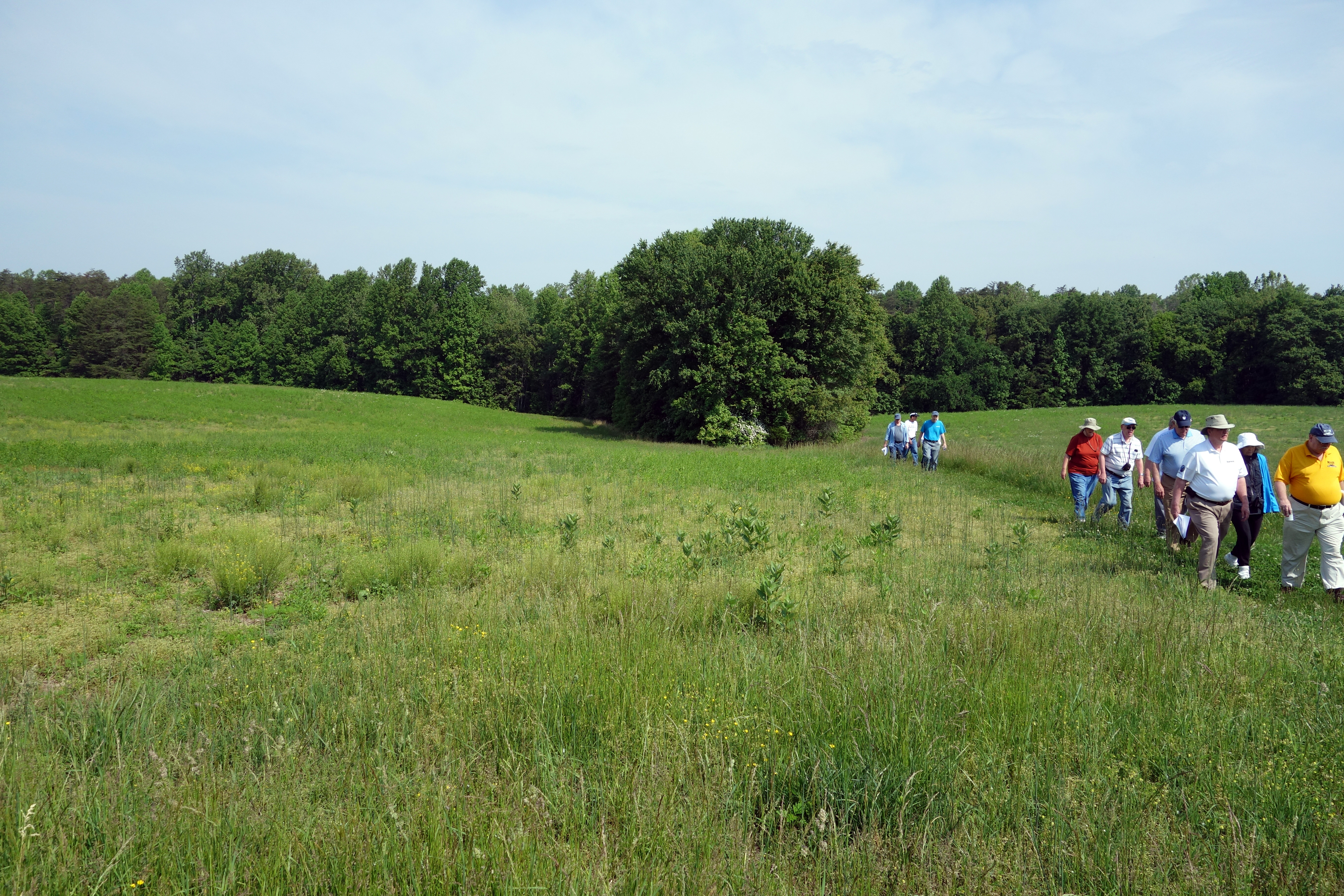
Our first battle stop was Saunders Field. This was essentially my first real visit to the Wilderness battlefield, and despite drawing maps of the battle, I had never really perceived the significance slope on the field that the Confederates used as part of their defensive position. After they created field fortifications on the slope, the defensive position was pretty formidable, and the V and VI Corps troops who tried to attack it would probably agree. There were field fortifications in evidence inside the woods at the edge of the field, but Gordon suspected that they were not the ones dug on May 5, but came a day or two later. The next stop was Higgerson Field, which was also part of the May 5 battle.


On the southern end of the battlefield, we visited the Widow Tapp Farm, over which Hancock launched a massive attack on May 6, comprising about half of the Army of the Potomac. This was the location of the famous "Lee to the rear" episode—the first of a couple during the campaign—in which men of the Texas brigade prevented Lee from riding forward into the battle. We took a moderately long walk around the field, passing by the location of the widow's house, but other than an interpretive sign, there was no evidence of a building. Then we visited a ritzy gated community called Fawn Lake, once again achieved by Gordon requesting permission from the owners, from where we were able to walk down the unfinished railroad grade. (This railroad, which connected Fredericksburg to Orange, was actually completed after the war, but was torn out again around the 1920s.) We discussed Longstreet's flanking attack that used this railroad grade as an avenue of approach. Gordon said that both Moxley Sorrel and William Mahone claimed after the war that each led this attack, but he tends to believe Mahone, the more senior officer and one who had personal experience as a railroad executive.
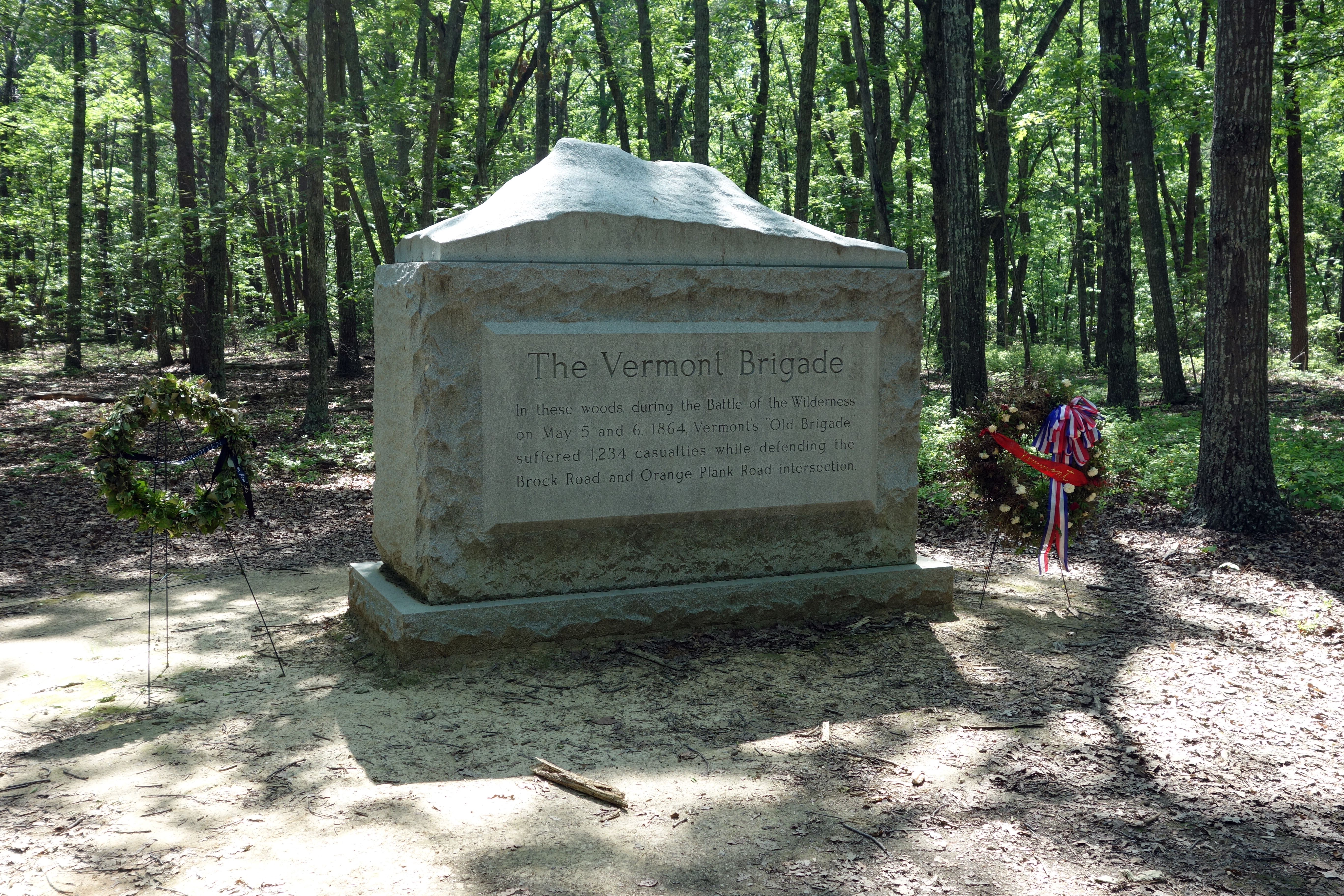
At the intersection of the Orange Plank Road and the Brock Road, we stopped to take a brief walk into the woods, where the relatively new monument to the Vermont Brigade stands. They suffered severe casualties somewhat near this location. The monument is a little unusual in that it has a 3-D representation of a Vermont mountain (Camels Hump, the third highest mountain in the state) on top.
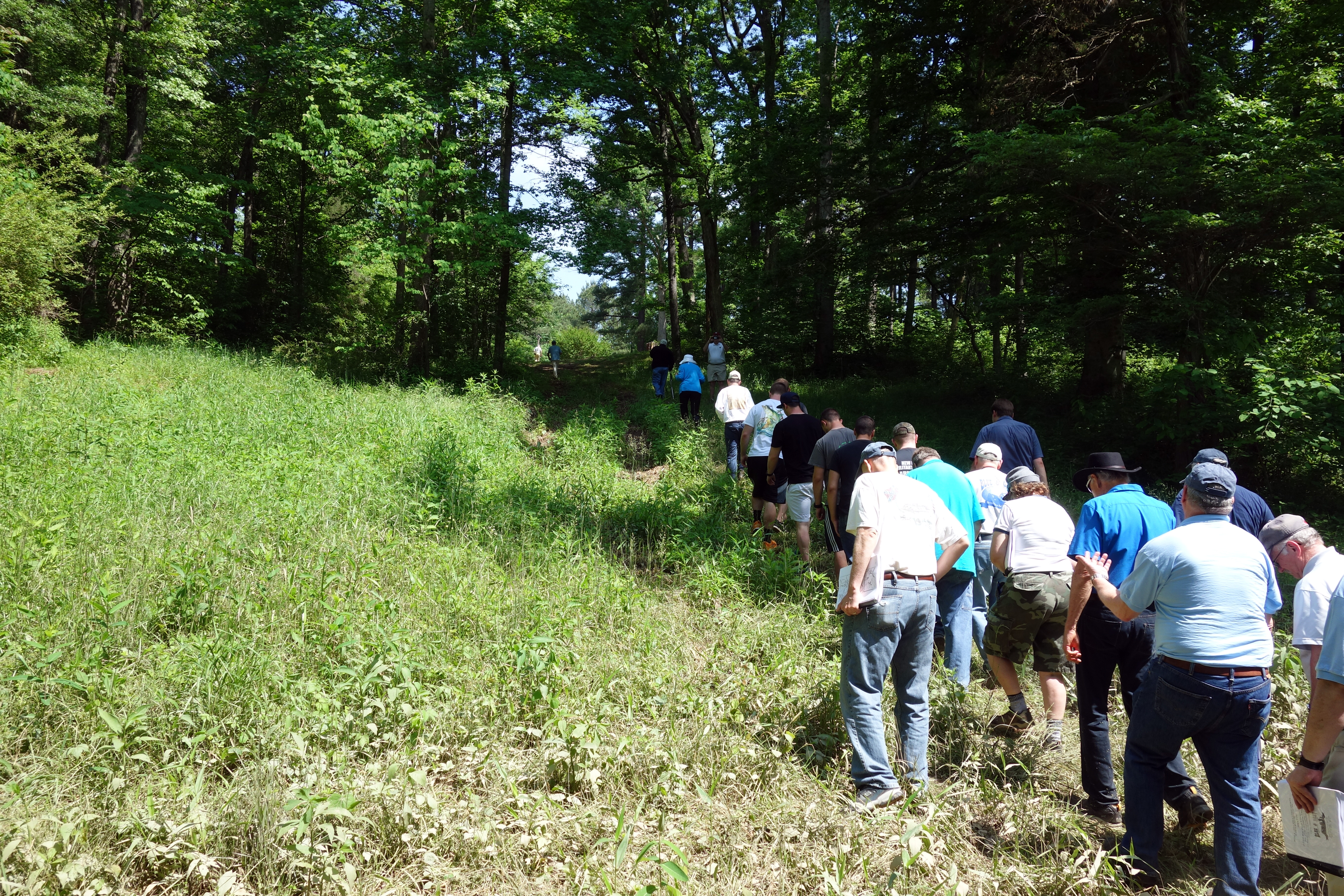
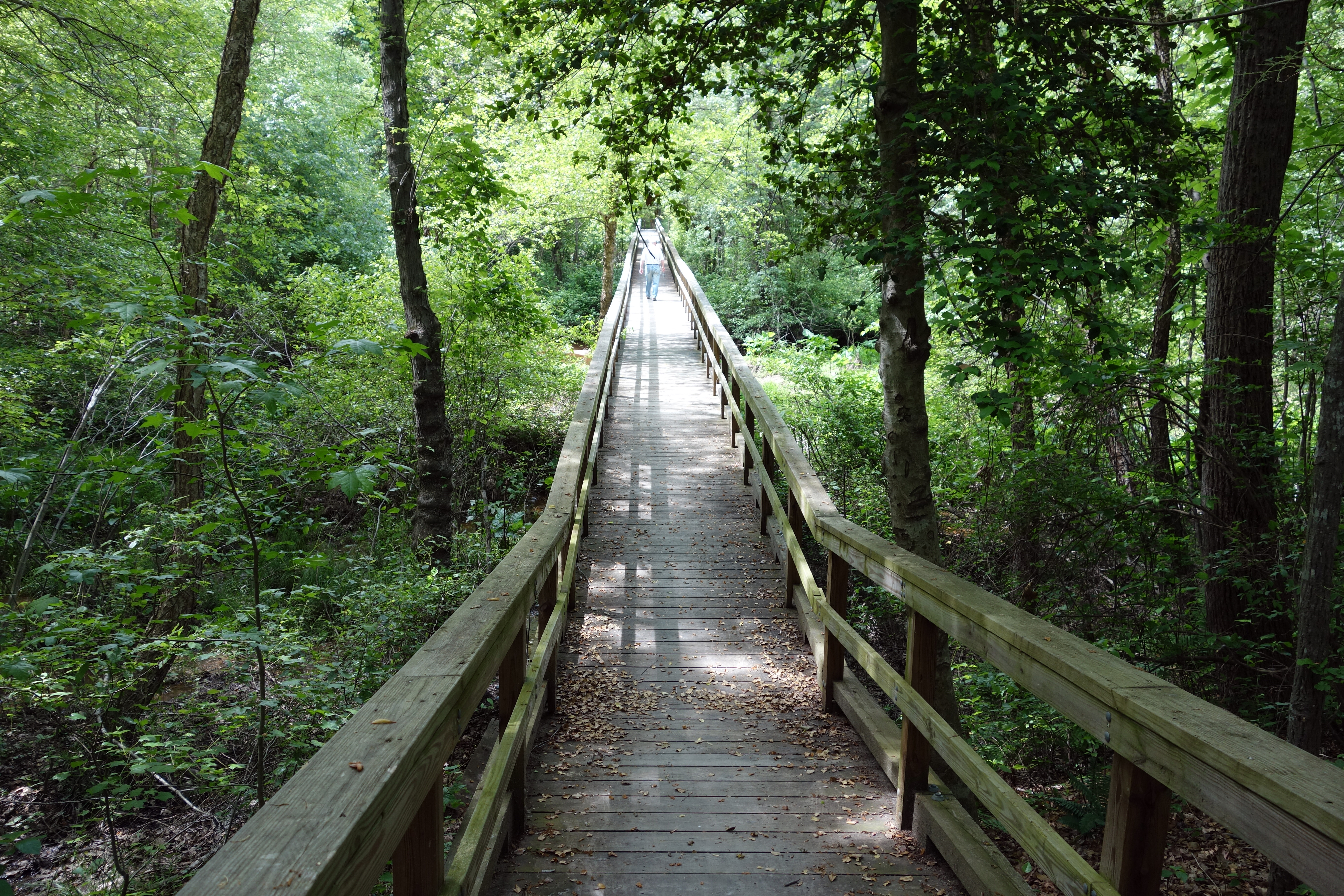
We drove back north to Saunders Field to pick up the final part of the two-day battle, the flanking attack launched by John B. Gordon against the unprotected right flank of John Sedgwick's corps. There is a two-mile loop trail that the NPS has arranged and about half of us had enough energy left over to take the walk. I actually thought this was one of the less productive exercises of the day, because it was essentially 2 miles of undifferentiated woods, and without some of the modest interpretive signs, you would never know anything happened there. That concluded our day and we returned to the hotel. Today was a really great experience for me, because it was my first in-depth view of this important battle. By coincidence, I received e-mail while I was in the field, Gettysburg College informing me that I have been selected for a one-day staff ride of the Wilderness at the Civil War Institute next month.
Wednesday, May 21 — Spotsylvania
We started our second day at the intersection of the Plank Road and the Brock Road in the Wilderness, where we discussed the movements of the armies to Spotsylvania Court House, beginning on May 7, including the famous decision by Grant to turn his soldiers marching south rather than retreating back across the Rapidan as his predecessors had done. Gordon thinks that this was the turning point of the war. We drove down the Brock road to Todd's Tavern, where we discussed the cavalry actions on May 7--8. We then drove to the Laurel Hill area, stopping on Hancock Road to take the trail through the woods that crosses the field and climbs up to the Confederate position. This is a moderately good defensive position, even though the Confederates did not have an opportunity to begin serious entrenchments before the first attack of the V Corps, because they had enfilade artillery fire. However, Gouverneur Warren's problem seemed to be that he assumed the Confederate First Corps defending the position was actually a small cavalry detachment, and he launched brigades against it in a piecemeal fashion. Gordon discussed the earthworks situation, saying that this was the first battle in the Eastern Theater in which the armies got very serious about erecting earthworks.


At Upton's Trail, Gordon described the actions of Winfield Scott Hancock at the Po River on May 10, and then we stepped off for a quarter-mile walk through the woods. When we emerged in the clearing, we were about 150 yards away from the portion of the Confederate Mule Shoe called Doles's Salient. Emory Upton led an innovative assault with 12 regiments that was able to break the Confederate line, but could not capitalize on its success because proper supporting units were not available. We had another picnic lunch, this time at the exhibit shelter near the entrance to the park. The weather today was once again beautiful, in the low 80°s, although a bit more humid than yesterday.

We drove to the McCoull house, which is situated close to the center of the Mule Shoe salient. Like many famous battle houses, it was simply a collection of foundations stones laid out to show where the house used to be. From there, we walked to the famous Bloody Angle, which is important not so much after the shape of the entrenchment line, but for its elevation—it is slightly higher than other parts of the line and therefore can dominate by fire all of the adjacent trenches. Therefore, it was the critical point for each side to seize or hold. At the angle, Gordon told us a few anecdotes regarding heroism in the 22 hour battle that raged there, including a description of the subject of his book, Carrying the Flag: The Story of Private Charles Whilden, the Confederacy's Most Unlikely Hero.


We walked to a trail called the Landrum House Road, then turned around and faced the Mule Shoe, from the vantage point of the Union soldiers that attacked it on May 12. We were able to see that there is a significant upslope that may be defensive position even stronger.

Then we drove to Lee's Final Line, where we took a look at a fake section of Confederate earthworks, and Gordon described how the Confederate line was withdrawn to the base of the Mule Shoe after it was overrun on May 12. We walked about a quarter-mile and encountered very well preserved Confederate earthworks, including some well defined artillery lunettes. They overlooked a slight downslope, which made them a significant defensive threat to the Union. (Grant ordered an assault against this line on May 18, which was easily repulsed.) From there, we went to the site of the Harrison House inside the Mule Shoe.

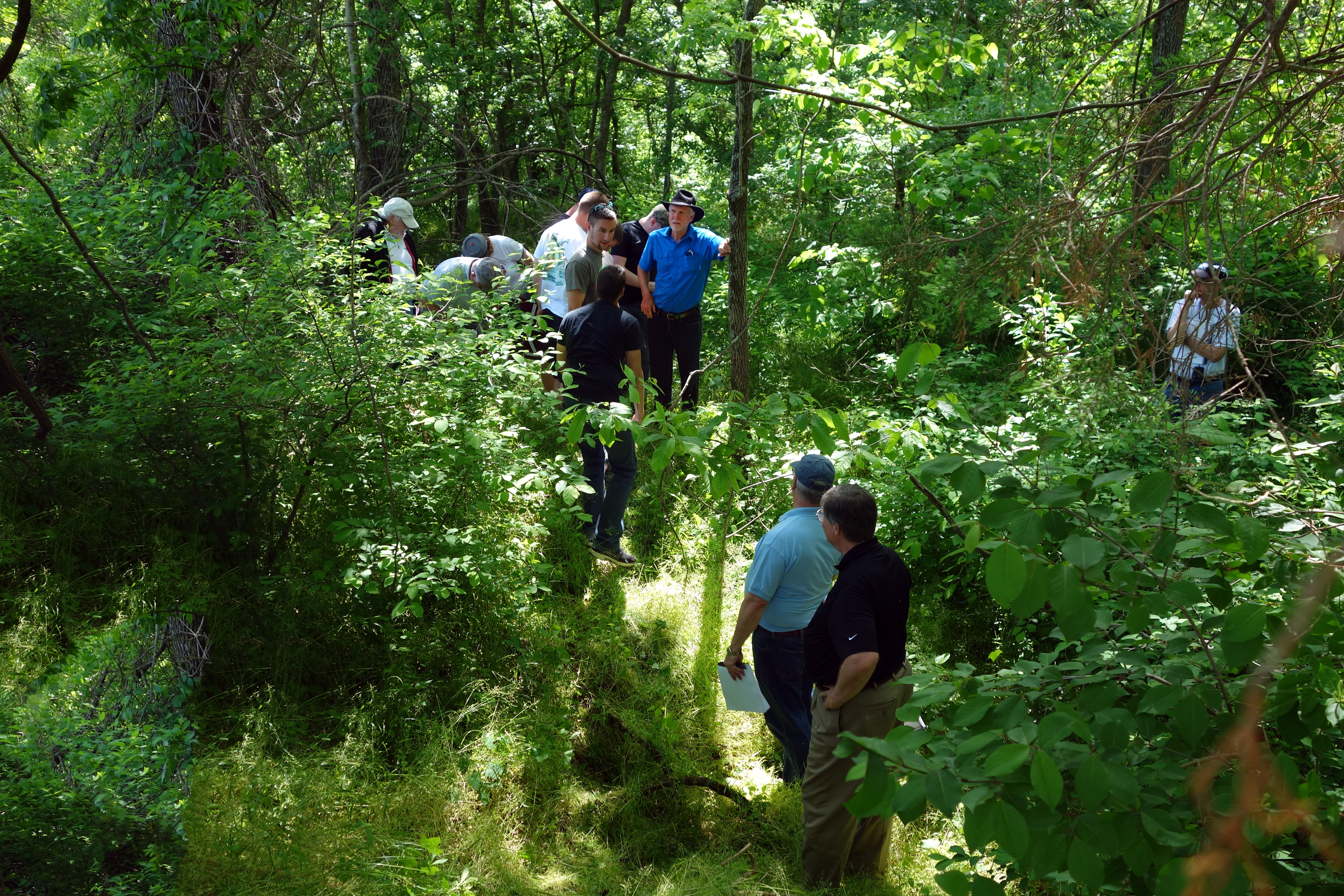
Our final stop on the main battlefield was Heth's Salient, on the eastern side of the Mule Shoe. Once again we walked about a quarter-mile into the woods, this time on a very poorly defined trail, but it was worth it because the earthworks were in excellent condition, including a number with visible traverses. (Unfortunately, photographs of earthworks rarely turn out well, and the ones I took just look like leaves on flat ground.) Here on May 12, Burnside attacked the salient at the same time the Confederates launched an attack against him.
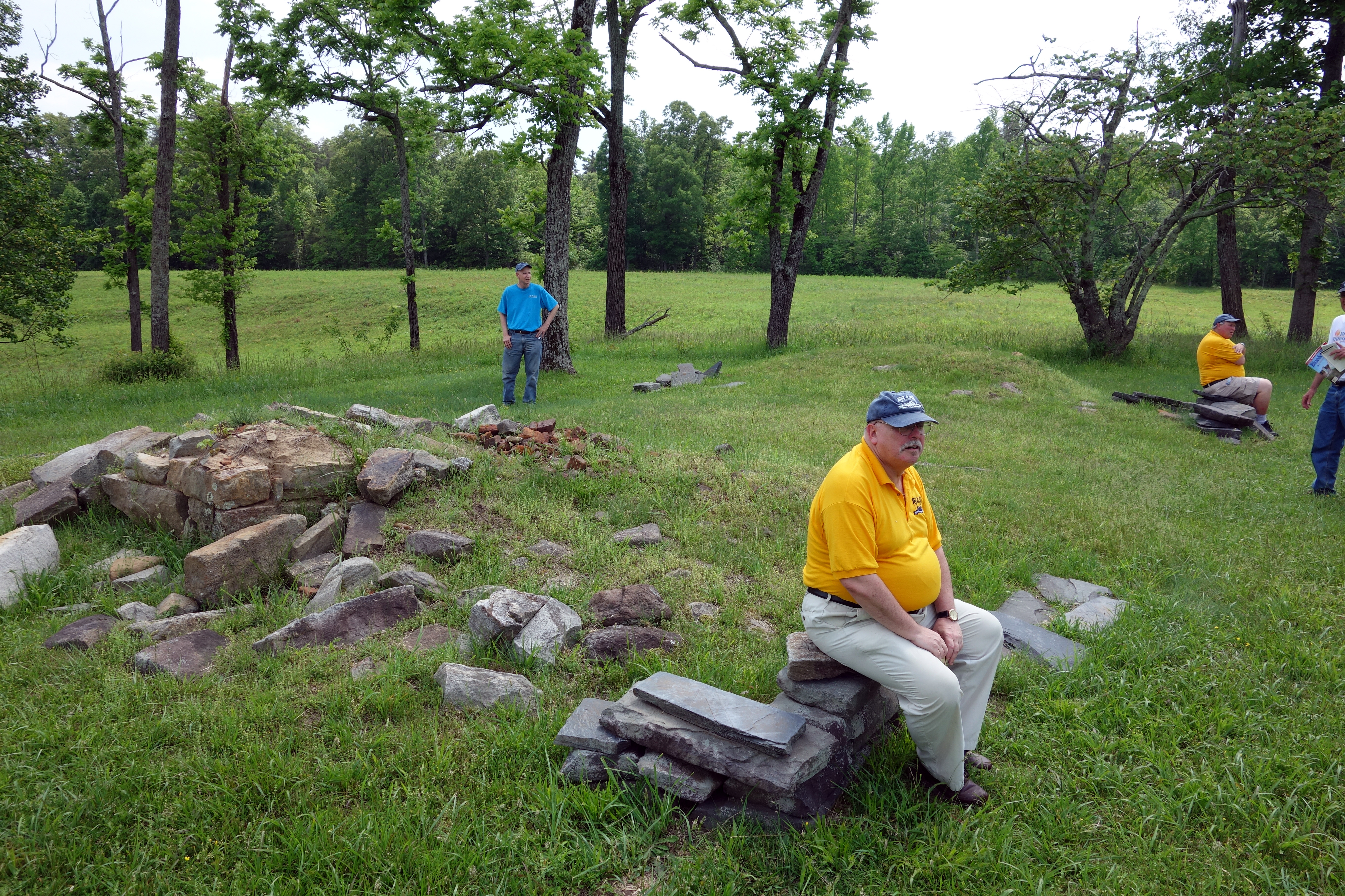
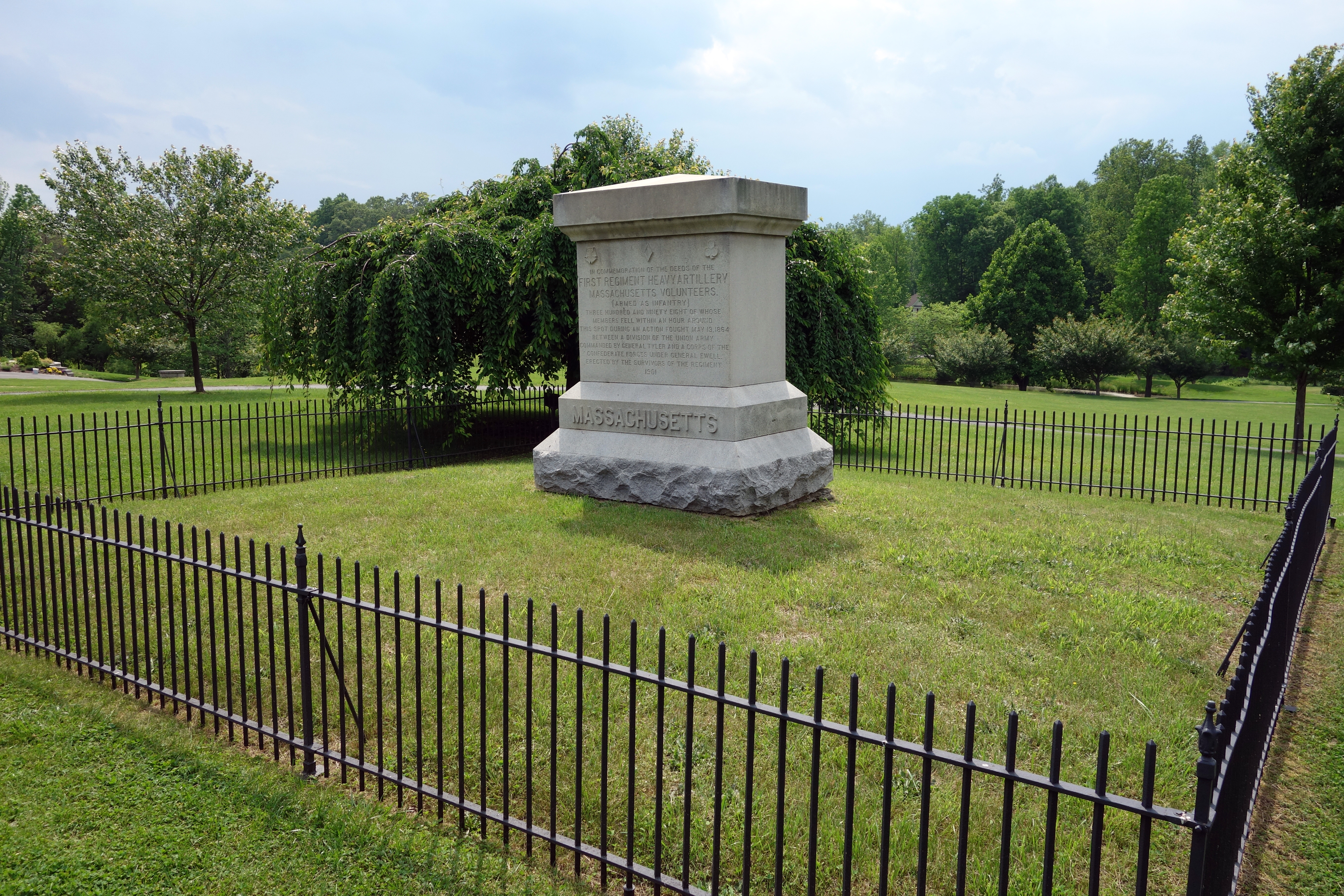
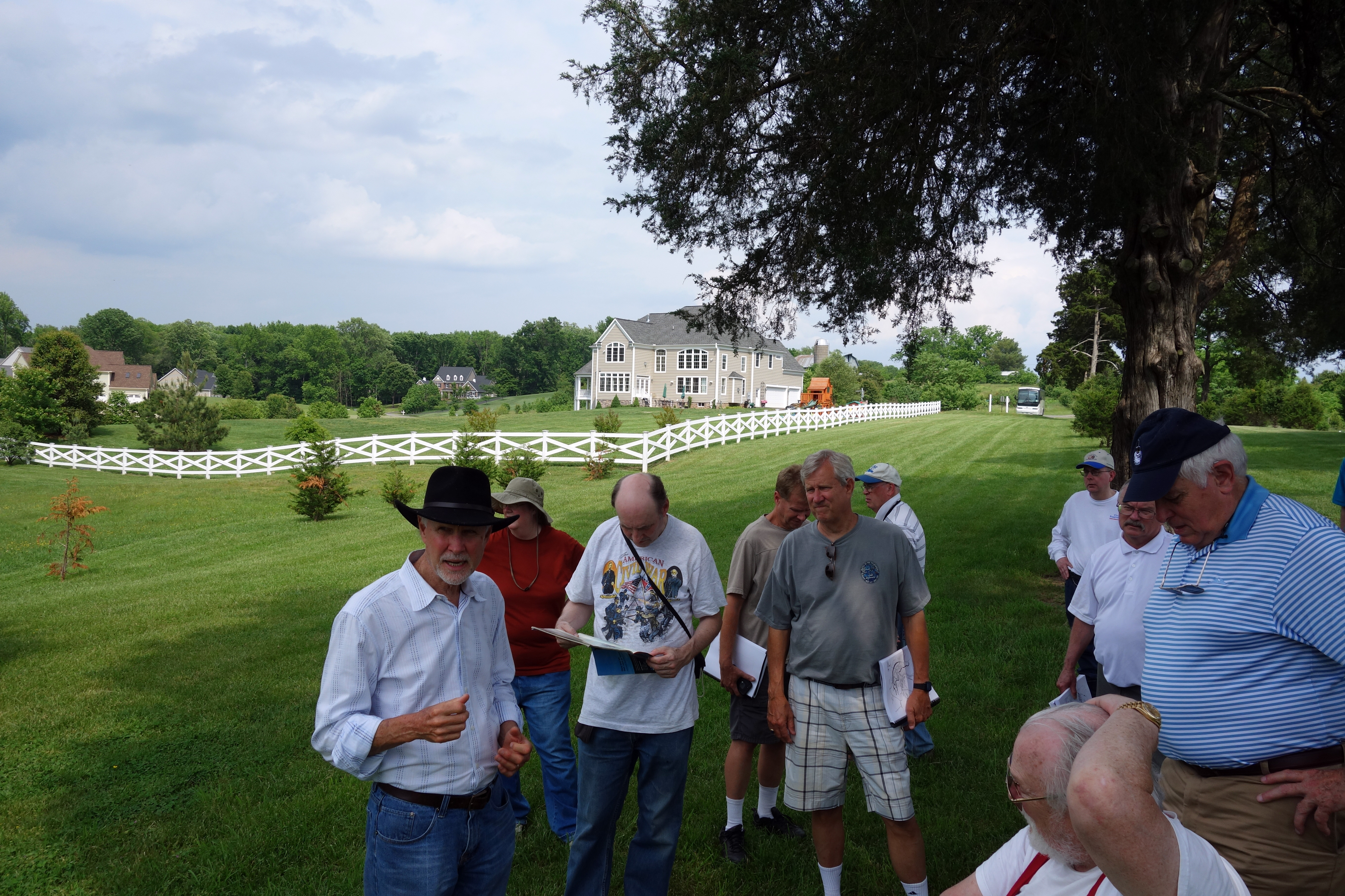
We drove out the Fredericksburg Road (now called Courthouse Road) and visited Harris Farm, where a battle occurred on May 19 between soldiers from Richard Ewell's corps and several units of Union heavy artillery soldiers who had recently been converted to infantry duty. One such unit was the 1st Massachusetts Heavy Artillery, which has the only monument on the small field. The preserved area is essentially like a town park, this one surrounded by huge McMansions in a development called Bloomsbury Farm Estates. The original Harris farmhouse is still there, and we saw it was for sale for $240,000 (according to Zillow). There was idle talk about getting the local preservation group to buy it.

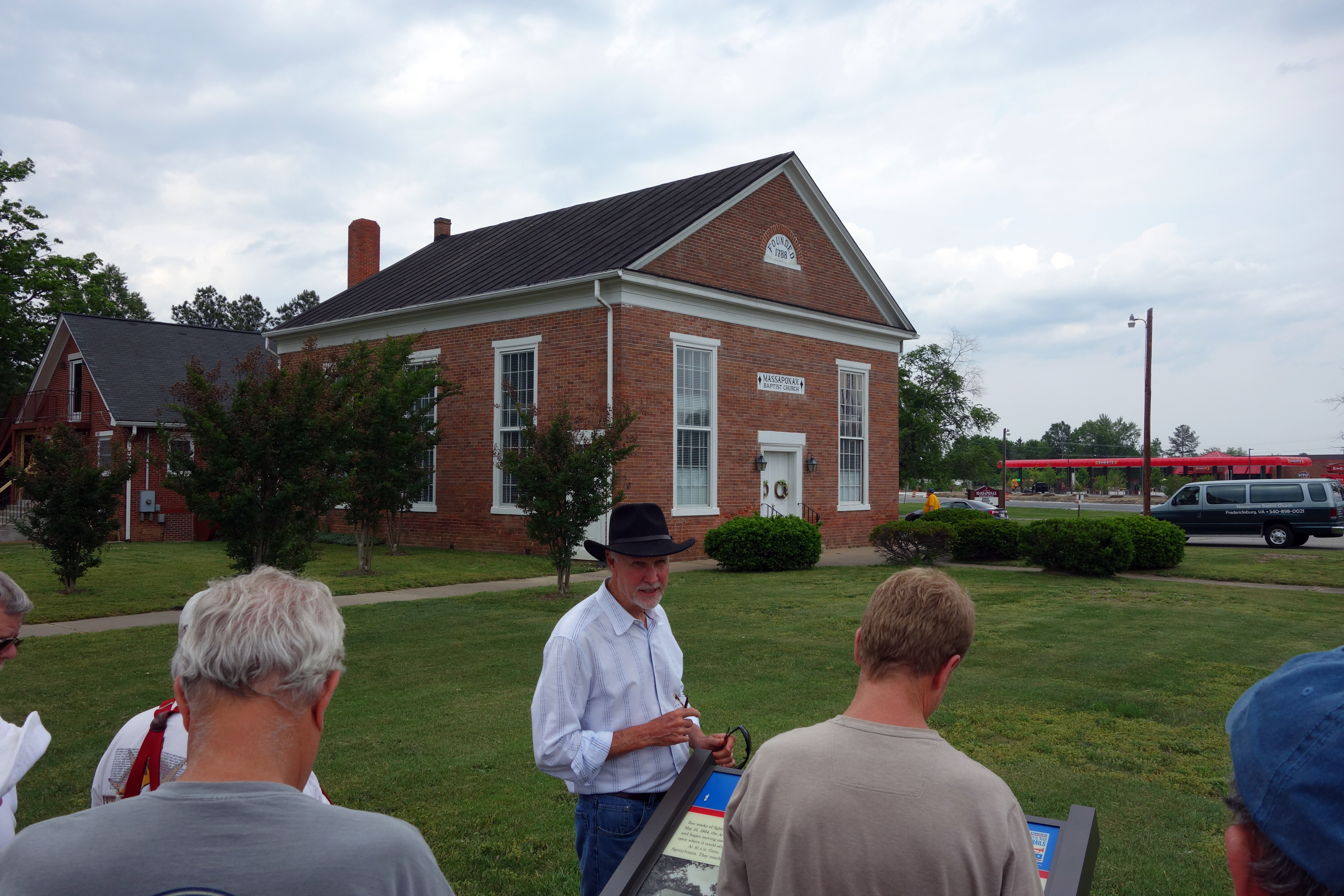
There was some time left in the day, so we drove to Massaponax Church, where the famous photographs of Grant and his staff outside on the church pews were taken by Timothy O'Sullivan 150 years ago today. Here Gordon described the beginning of the Union movements to the North Anna River starting on May 20. We had hoped to get inside the church to see Union graffiti on the wall, but it was locked up and we will try again tomorrow morning.
After the tour, I ran into Gordon at the hotel lobby and he told me he was going to go out scouting the itinerary for Thursday and invited me to go along. We found a railroad crossing that we knew the bus would not be able to traverse without getting stuck, so planned an alternative. We explored some of the routes of the Union march on May 21, including some detours we would have to take because of a new highway, and mutually decided that this would be too much driving for very much benefit. Gordon's new plan will take us on the Confederate route (US 1, the Telegraph Road) instead, leaving us more time for the battlefield. We also stopped by Stanard Mill (built in 1723) and got permission from the owner to approach with our bus and climb the hill to see the earthworks overlooking the Po River. The owner, Joyce Ackerman, who says she is a descendent of a soldier who scouted for Jeb Stuart, has lots of artifacts that she is happy to show, so some of the people who are not hill climbers will probably get to talk to her tomorrow. Gordon and I got to visit her basement, which is reached by raising a large trap door in the living room floor and climbing down a very precarious set of steep stairs. Unfortunately, there was nothing really interesting to see in the basement, so we will unlikely subject any of our colleagues to that. Maybe Len. :-)
Thursday, May 22 — North Anna River
Today was a day without many monuments or sweeping battlefields vistas as we followed Grant and Lee to the North Anna River. We started with another attempt at Massaponax Church (which is quite near the hotel), but once again it was closed. Someone had the bright idea of calling ahead and we may try that tomorrow. Then we headed down the Telegraph Road passing by Mudd Tavern, which was owned by the same family that achieved infamy in the John Wilkes Booth escape. The building is still there today, but it is now a Mexican restaurant named Poco Loco. Our first stop was Stanard's Mill on the Po River. During the movement south, Ewell fortified a few miles of the Po, aiming to prevent the Union from using the Telegraph Road. Ambrose Burnside did attempt to take his corps down the road, but skirmishing near the mill convinced him that Confederate position could not be broken, so he turned around and went back. That road was not an ideal avenue for the Union Army because it would require them to cross a number of rivers on the way down, so they opted instead for a wide swinging movement east through Bowling Green and Milford Station, using the Mattaponi River as a screen for their movements.

Stanard's Mill (now named Roxbury) is the place Gordon and I visited last night, so we got to see Mrs. Ackerman again and she was delighted to welcome the entire large group into her home to see her artifacts and hear her stories, including the one in which she described living near Guinea Station, and as a child jumping up and down on the bed in which Stonewall Jackson died. Then we climbed into the hills and took a look at the trenches, which were in good shape, and Gordon said that they stretched about 2 miles in each direction, although we obviously did not have time to walk the entire line.


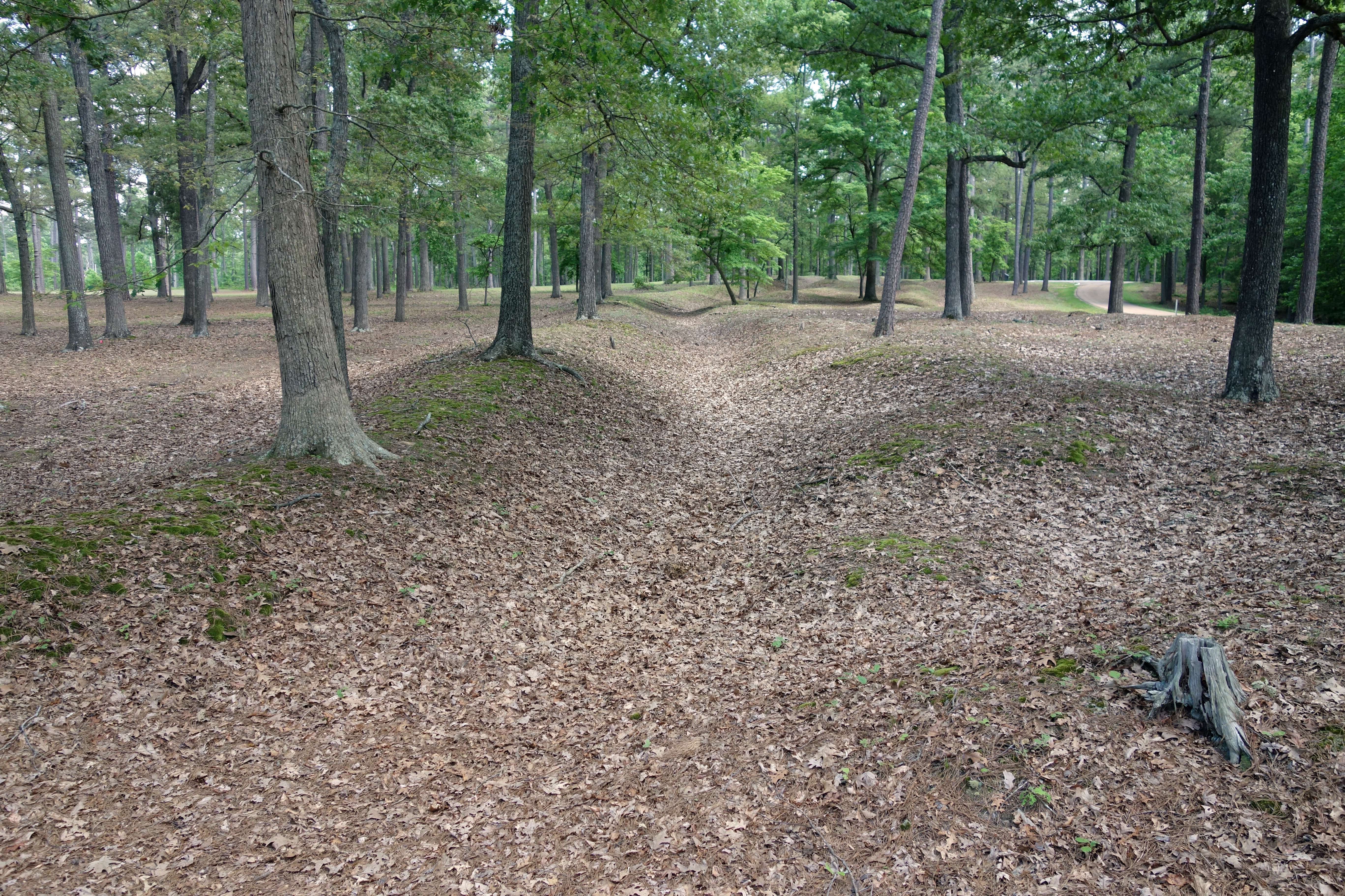
We headed back down the Telegraph Road, stopping briefly at Nancy Wright's Corner (or at least nearby, because that corner is on the old Telegraph Road, which does not exactly match modern US 1, and according to the USGS map I had, we actually stopped at Ann Wright's Corner). Next was Mount Carmel Church, about 3 miles north of the North Anna, where the Union corps converged in their march and Meade and Grant had their headquarters. Here we happened upon a group of Norwich cadets who were also on a tour of the Overland Campaign, and whom we had encountered three or four times the previous day around Spotsylvania. Gordon invited them to accompany us to our next stop, which was private property on which Henagan's Redoubt stood. We climbed a very slippery slope in the woods and it was revealed that this was in fact the earthworks of the redoubt, where four regiments of South Carolina men defended the bridge over the North Anna, but were overwhelmed by an attack from the II Corps. Getting up was quite a chore, and we wished that we could have been like the Union soldiers, who stuck their bayonets into the earth to get traction on the way up. Although everything was covered with vegetation, the underlying earthworks were in great shape. (I felt guilty standing on them.) On the same property were the remains of the Chesterfield Bridge, which the redoubt attempted to protect.


We took a short drive through Hanover Junction (now called Doswell), and saw the famous rail intersection that was so important to the Confederates. It is a very tiny town with a couple of cute antique shops. From there, we drove a few miles to the North Anna Battlefield Park, where we had another picnic lunch. BGES has been collecting money to make improvements to the park, and I was anxious to see what they had accomplished. I had visited here in 2006 and there was a trail that followed one leg of the Confederate entrenchments out to Ox Ford. This trail is now called the Gray Trail and the money has gone toward clearing and interpreting a new trail called the Blue, which takes you out in the woods to follow the very foolish and unsuccessful attack of James Ledlie's brigade into that line of entrenchments. The original trail is quite interesting, a crushed rock path through relatively heavy woods, through which you can see very nicely defined earthworks, interspersed with 10 very informative signs, each with maps. The stop that should have been the most interesting is the one overlooking the river, but the vegetation was so heavy you could barely see it. It is good I remember my previous visit, when it was apparent that the river is fronted on the south side by very tall, steep cliffs. It is quite an unassailable point. We started walking on the blue trail, but after a few hundred yards we had to turn around and avoid construction workers finishing up a bridge or something. It was also disappointing that none of the new signs created by BGES were installed yet.


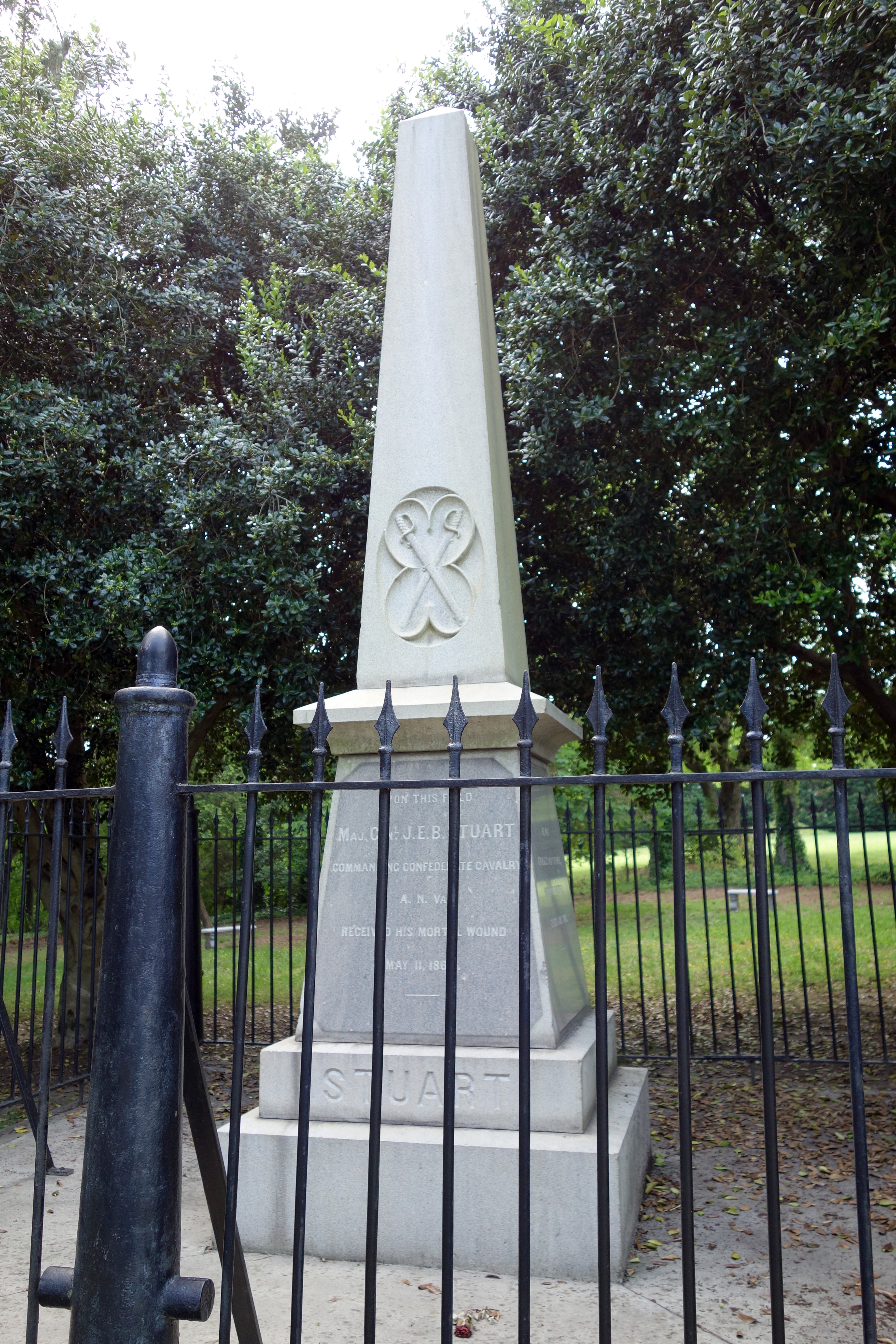
We ended up walking about 3 miles, I would estimate, but we had planned on going at least 6 if the new trail had been open, so we did not use up as much time as expected. Therefore Gordon offered us a few choices of what to do for the rest of the afternoon, and we chose to drive to Yellow Tavern and talk about the cavalry actions of the campaign. Actually, we visited the Jeb Stuart Monument in Ashland, which I believe is about a mile north of the historic Yellow Tavern itself. Even with the extra stop we got back to the hotel a bit early, giving us some time to recuperate. The weather was good again today, although pretty humid, and that really saps some of the energy from you.
Friday, May 23 — Cold Harbor
Our final day with the BGES crew started with a third attempt to get inside Massaponax Church to see the fabled graffiti. Once again, no joy in Mudville. So we set off to follow some of the Army of the Potomac on its withdrawal from the North Anna battle lines. Grant's ability to withdraw from this close contact and fool Lee about his intentions was pretty masterly. He decided to swing around east of the Pamunkey River, which would be used as a screen. Our first stop was Mangohick Church (which is pronounced not like the fruit, but like the planet in Flash Gordon), where Meade and Grant arrived on May 27 along with the V and IX Corps. Then we crossed back over the Pamunkey on Nelson's Bridge, although it was a modern bridge (thankfully), which was where the II and VI Corps crossed. Just before we crossed we got a drive-by view of Wyoming, the large 1795 house owned by the Nelson family. We also passed by Salem Church, which would have been the chronologically correct place to visit, but we were on a schedule to reach the Shelton House at a specific time.

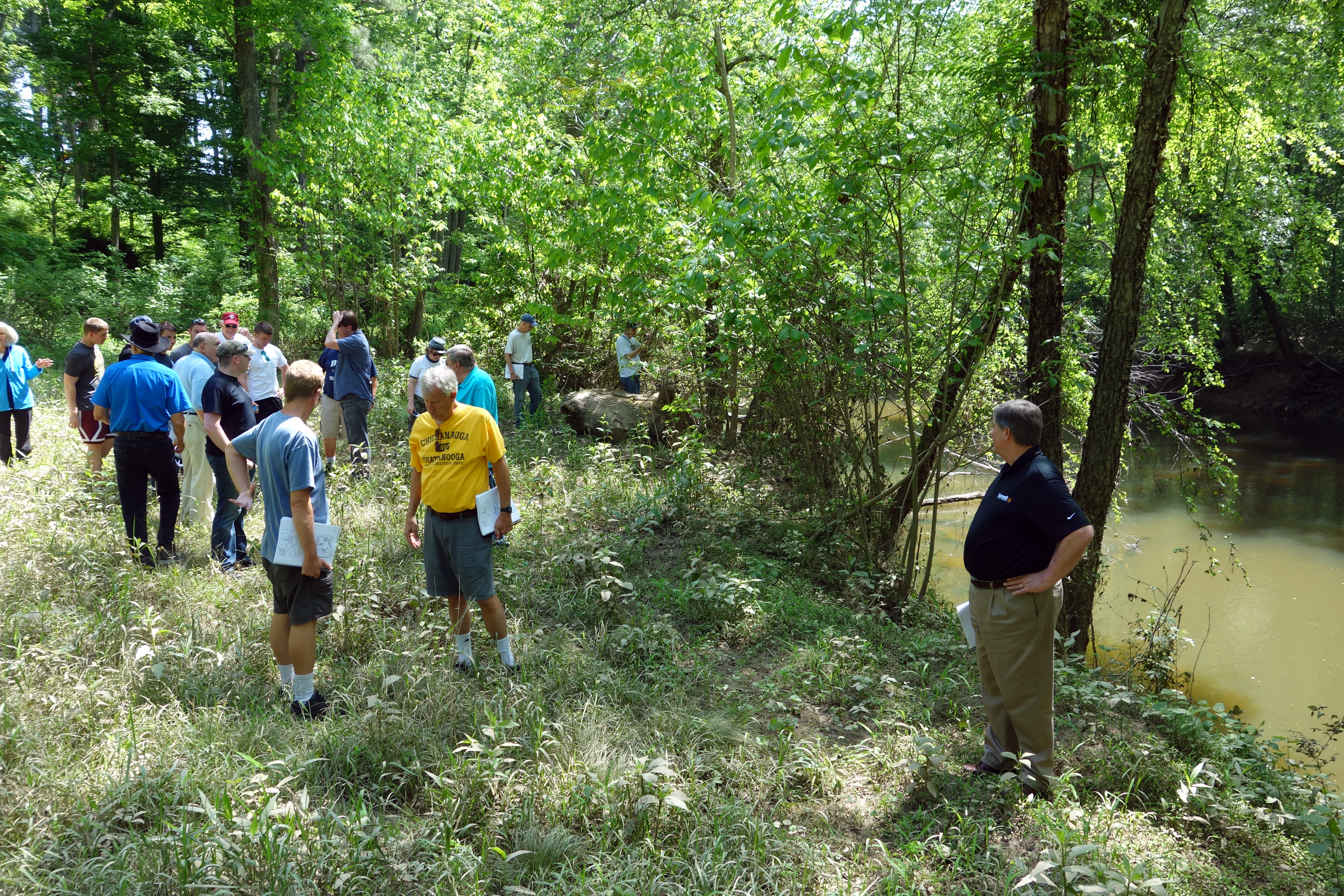
At the Shelton House, "Rural Plains," we were met by Bobby Krick, historian at Richmond National Battlefield Park, who graciously agreed to open the house for us. The house, built in the 1720s, has been in NPS hands since 2006, but it is not fully restored, nor completely full of furnishings, so it is only available on some weekends. Prior to the Civil War, it was famous because it was the supposed location of the wedding of Patrick Henry to Sarah Shelton. (The wags at the National Park Service say that it was here he spoke his famous quote, "Give me liberty or give me death.") Bobby gave us a brief history of its involvement in the Overland Campaign. It served as Winfield Hancock's headquarters and was hit 53 times with artillery shells, causing quite a bit of damage, some of which is still in evidence in the attic. Two signal officers were on the roof and they supposedly kept signaling even as the shells injured them. We were given a choice of either going through the house to see its single room of furniture, or taking a walk to Totopotomoy Creek, and I elected the latter along with five or six others. It was about three quarters of a mile away on a good path and I was very interested to see how dramatically steep and defensible the Confederate positions were on the southern shore.


Our next stop was Enon Church, about where the Confederate position was in the Battle of Haw's Shop, a cavalry duel between David Gregg and Wade Hampton as Sheridan attempted to find out where Lee's army was located. (The battle itself was inconclusive, but Hampton prevented the Union cavalrymen from finding Lee.) The battlefield is one very large open field and you can see all the way to Salem Church and the wartime location of Haw's Shop.


Next we visited Polegreen Church, a landmark caught up in the Battle of Totopotomoy Creek, which had some antebellum religious significance as an early "dissenter church.". The church was destroyed by Confederate artillery fire and it has been replaced by an open frame structure that shows the outline of the historic building. There we saw some of the earthworks for Jubal Early's Corps (Early having replaced Ewell after Spotsylvania Court House) and discussed how Grant was testing the Confederate line on May 30--31. The Battle of Totopotomoy Creek was a Confederate defeat, one of their few defeats in the entire Overland campaign, and it gave Grant some of the confidence he needed to launch his aggressive assault at Cold Harbor on June 3.
We drove past the site of Bethesda Church, but did not stop because the area is completely developed commercially. Gordon had described this battle between Jubal Early and Gouverneur K. Warren at the previous stop. Next it was to the Cold Harbor battlefield and had our picnic lunch next to the Garthright House. We drove over to Beulah Church (which I could not photograph because our bus driver parked his giant bus right in front of it), where Gordon talked about the movements of the armies away from Totopotomoy Creek and toward Cold Harbor, including fresh troops—the Confederate division of Robert Hoke and the XVIII Corps of Baldy Smith. This church was Smith's headquarters. At the Cold Harbor Visitor Center we watched an electric map presentation and it seemed as if almost everyone on the bus bought books or T-shirts. I bought a collection of the Ed Bearss maps of the battle.
Right outside the visitor center was roughly the Confederate position (Hoke's division) on June 1. Gordon gave us an overview of the cavalry actions on May 31 and the June 1 attack. We took a battlefield walk that covered Ricketts's division assault, which happened upon an opening in the Confederate line caused by the (ordered) movement of Hagood's brigade, centered on a ravine that the Park Service calls Bloody Run. Our walk took us through that ravine.


We drove on the park road to near Middle Run, seeing the line where the Union line faced off against the Confederates from June 3 to June 12. Gordon described the movements of the units and the motivations for the June 3 Union attacks, as well as the disagreements between Meade and Grant, which had finally come to a head and represented a breakdown in communications that sent off the Union soldiers without coordination between the corps or with any reconnaissance. Gordon said that the popular story about soldiers being seen pinning their names inside their uniforms before the attack is probably a myth, although there is documentary evidence this did happen in the Battle of Mine Run the previous year. He gave us an overview of the June 3 attacks and said that there was no uniform assault across the entire line. The II and XVIII Corps were heavily engaged, the VI Corps sent only a couple of brigades forward, and the rest of the army did little.
Gordon concluded his discussion of the battle with information similar to what he talked about when we visited Cold Harbor with the Civil War Trust in 2010. The conventional wisdom from many histories is that from 7,000 to 10,000 casualties occurred in only the first 20 minutes of the June 3 assaults, but he opined that that was based on original accounts from Evander Law's Alabama Brigade. They were at a point in the line in which casualties were very heavy and apparently some authors have extrapolated their observations. He said that his exhaustive research on regimental casualty returns demonstrates that there were about 3,500 casualties in the main assault (and about 12,000 Union casualties for the entire multi-day battle). He said that he had the opportunity to discuss Grant's strategy with a number of modern generals and many of them agreed that his approach was generally sound—he had a nontrivial possibility of breaking through the line and crushing Lee's army, whose back was to the river, so it was a chance worth taking. Unfortunately, the attack fell apart at the operational level. Gordon referred to Grant as being reasonable, not a butcher.
We took walk up the middle ravine, where the XVIII Corps took so many casualties, and saw how well the Confederate entrenchments and artillery lunettes were laid out. We concluded with a discussion about the four days it took to arrange a truce between the armies, and Gordon judges that both generals were to blame, although difficulty in sending messages between the lines did not make things any easier for them. We had a discussion about the overall results of the campaign. I think we ended up concluding that although Grant could not be considered the Victor at any of the individual battles, he accomplished his campaign objectives of rendering Lee's army impotent, whereas Lee failed in his objective of maintaining the Rapidan line and avoiding the eventual siege. The campaign casualties were about 55,000 for the Union, 33,000 for the Confederates, but this represents a higher percentage of loss for Lee than for Grant.

On the way out, somewhat pressed for time and concerned about pre-Memorial Day traffic, we drove by, without stopping, the point in the Confederate line known as Breckinridge's Salient and also the monument to the 2nd New Hampshire Heavy Artillery (one of only two monuments on the field). On the bus ride home we watched a video about D.H. Hill, believe it or not. So it has been a great week with Gordon Rhea and BGES, and I commend them both for putting together a super program.
Saturday, May 24 — North Anna, Bermuda Hundred, and Cold Harbor
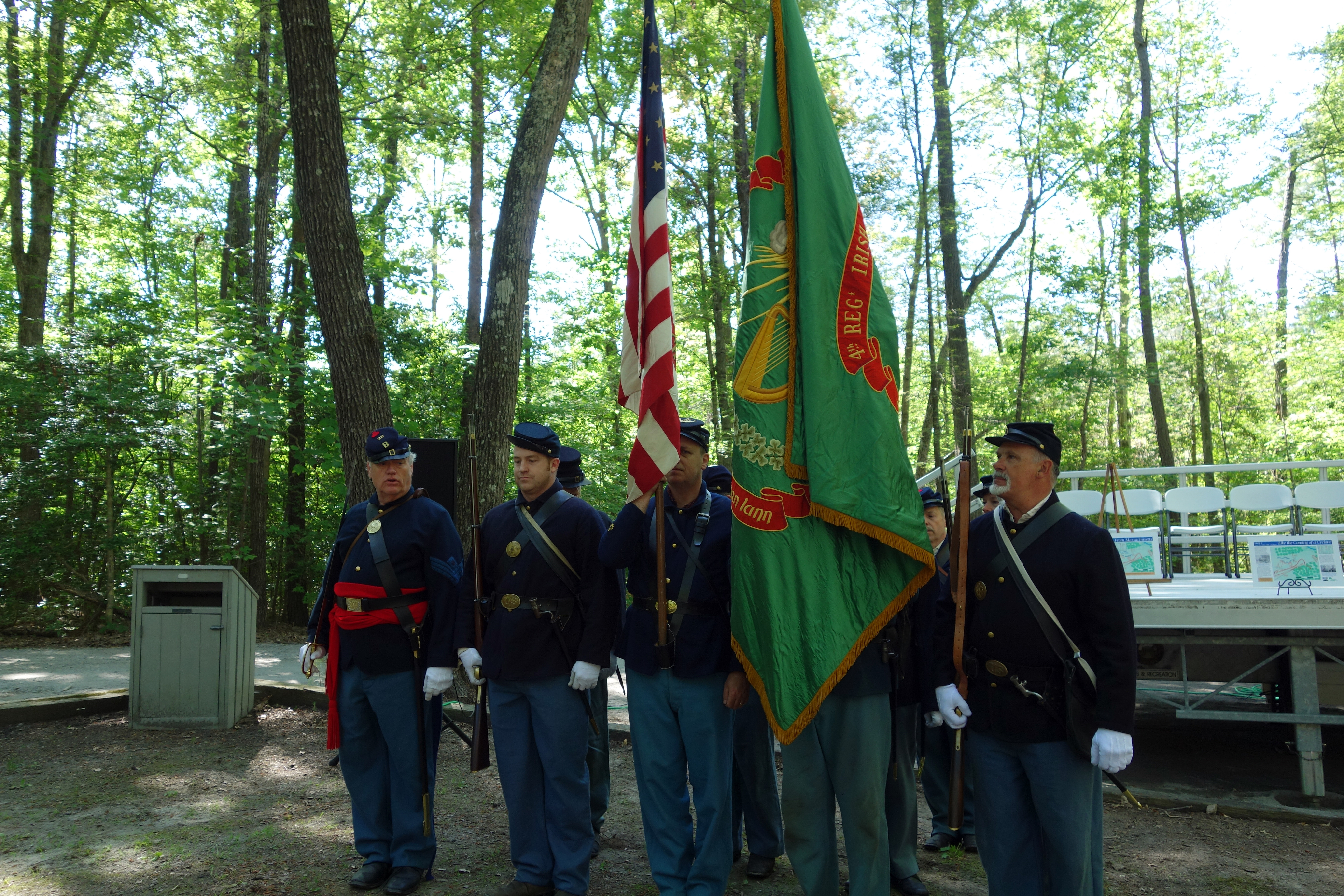
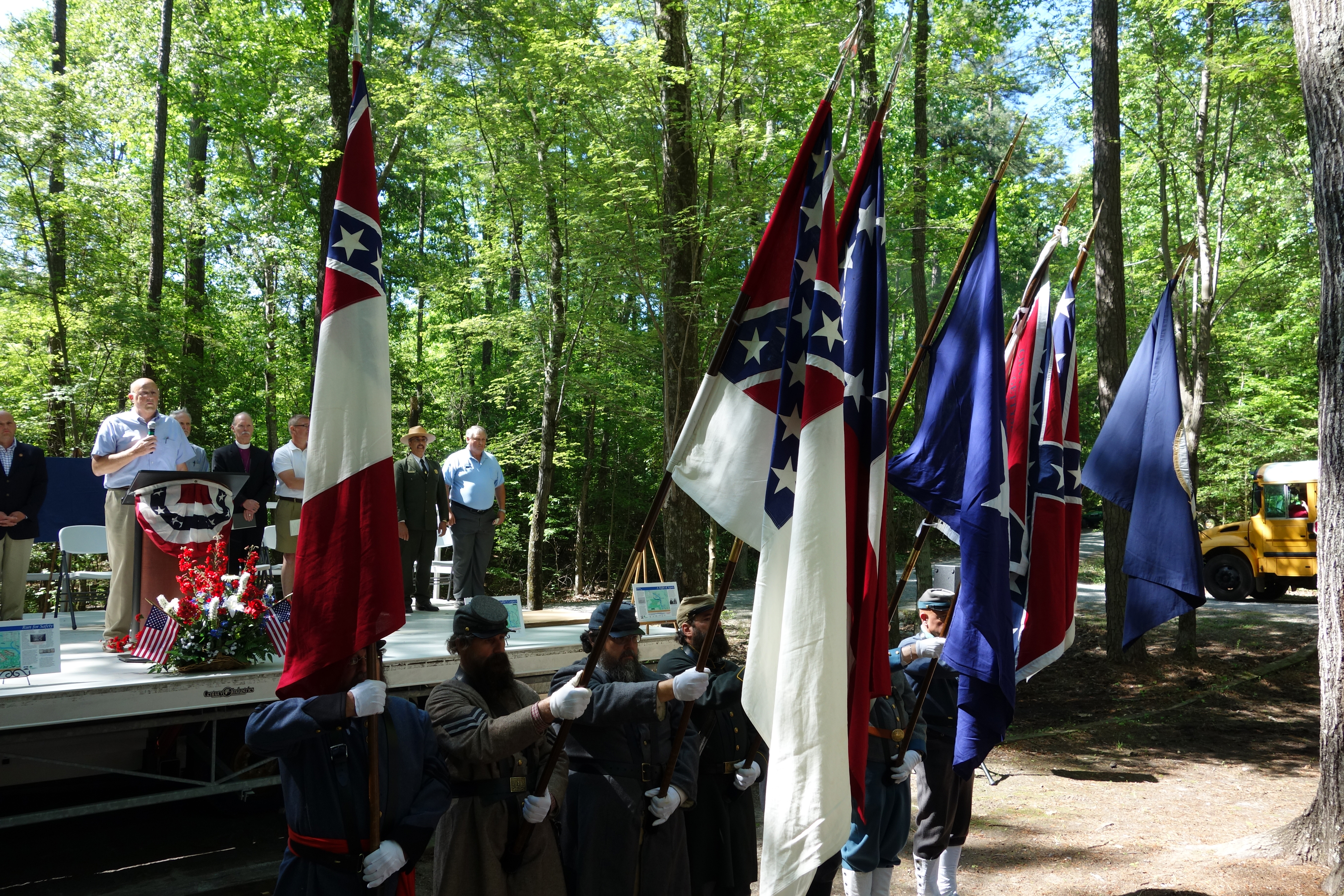
Today is the 150th anniversary of the most significant fighting on the North Anna River, so this day was selected to dedicate the expansion of the North Anna Battlefield Park. I attended a nice dedication ceremony along with about 100 guests and dignitaries. Since the parking area is rather small, we stopped at a nearby community center and took school buses to the park. My bus had a number of Confederate reenactors, who spent the short trip ragging on Yankees and smelling like the inside of a Philip Morris factory. There were US and Confederate color guards and we did a Pledge of Allegiance as well as a salute to the Virginia flag, both of which were printed up in the program for our edification. A reenactor fired a three gun salute on a rifled musket (he was able to reload and fire pretty quickly!) and a gun crew had a reproduction of an unusual cannon, a 12-pound Tredegar Napoleon smoothbore, which was much closer in appearance to a Parrott rifle, with a large reinforced firing chamber. The crew was one of the slowest I have ever seen and would have been overrun by Yankees between shots.

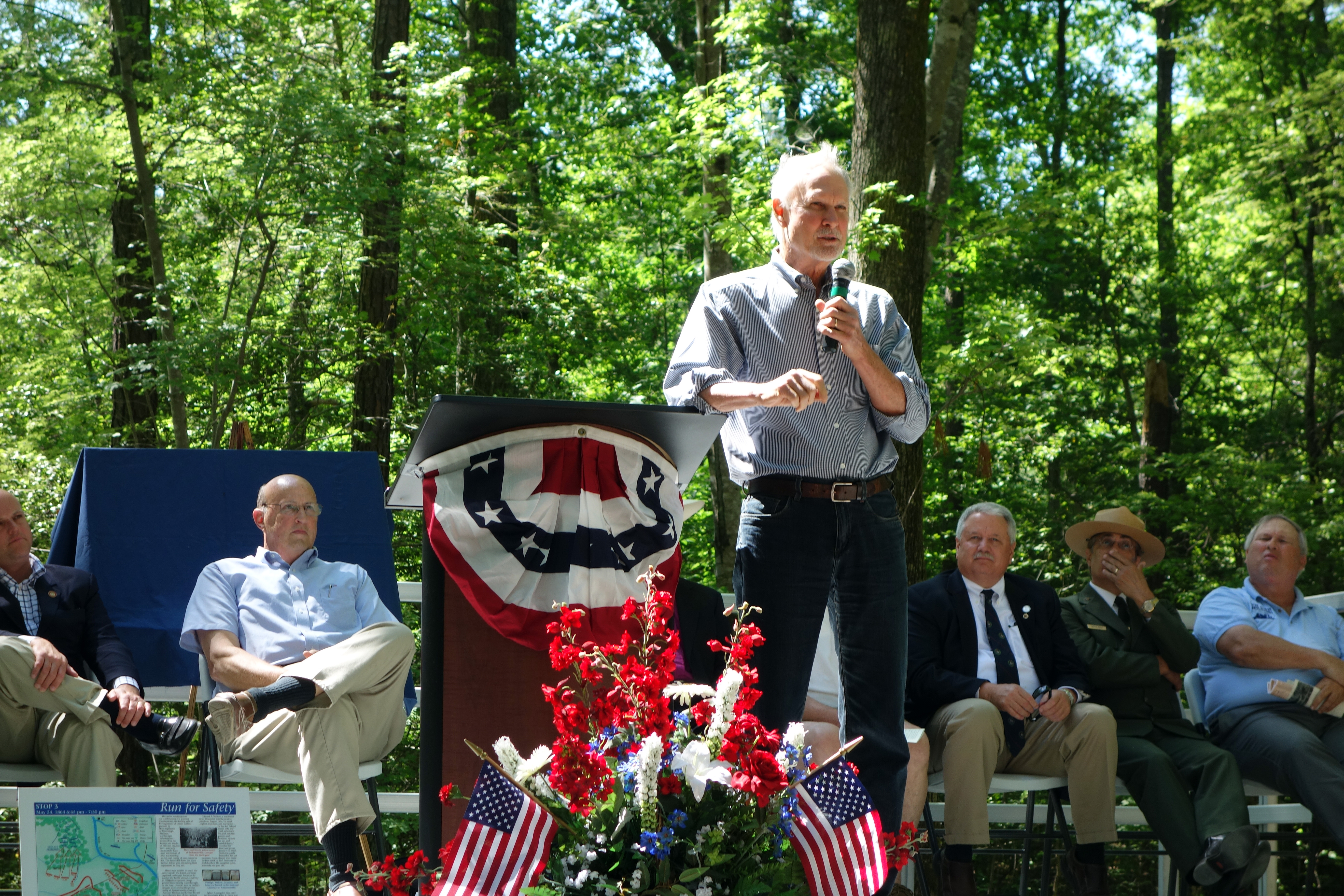
A number of local politicians gave little speeches, as did Len Riedel, and Gordon Rhea did the keynote address, which was essentially a summary of the Overland Campaign with a little bit of detail about the fighting at North Anna. Gordon was presented with a gift of a print by a local artist depicting the death of Lt. Col. Chandler during the battle and he said he would put it in his living room, muttering soto voce "if my wife lets me." That of course is an all-purpose excuse to relieve yourself of any obligation. :-)
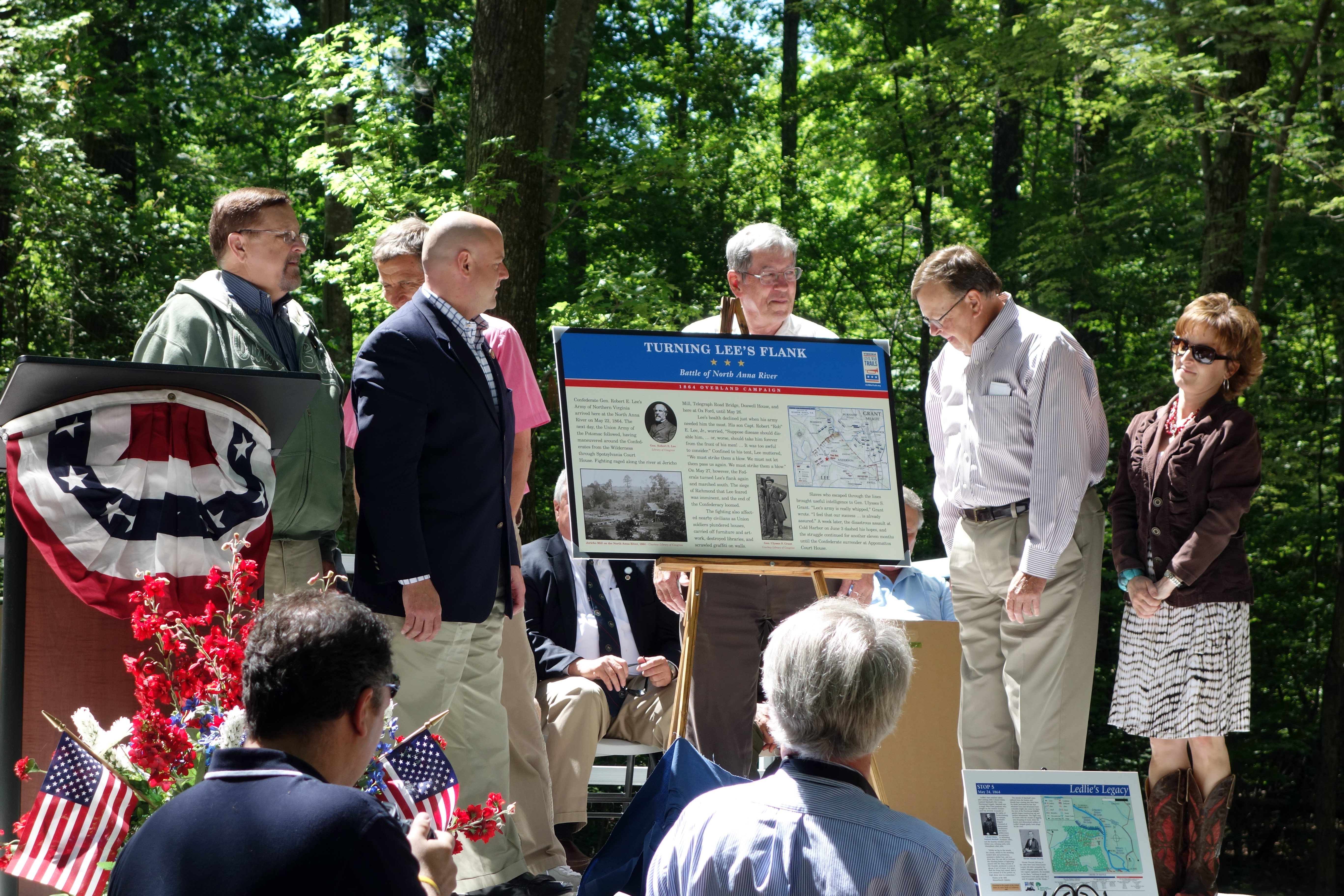
As I mentioned earlier, the new Blue Trail and 90 acres (I think) of newly preserved land were being dedicated today. I chose not to walk on the new trail because the signage had not been erected. I am sure that I will come back here one day and hope to enjoy the full experience. Instead, after about two hours of festivities, I hit the road and headed south. My original plan for this trip was to extend my stay to attend the ceremony as well as another on Sunday for signage in Bermuda Hundred. However, the latter was canceled or postponed, and if I had known that, I would have scheduled my flight for Saturday afternoon. Anyway, I headed down to the Bermuda Hundred area armed with a guidebook. (It turned out that many of the signs that had been installed already were based on the identical content of this book published by the Chesterfield Historical Society.)
My first stop was City Point, in Hopewell, Virginia, not because it had a lot of importance to Bermuda Hundred, but because the National Park Service commemorates US Grant's headquarters and the giant logistical depot that was installed there for the Richmond-Petersburg Campaign. Grant stayed in a tiny cabin there from November 1864 to the end of the war. The cabin has about 10% of its original material, so it is mostly a reproduction. You can't go in, but you can look through the window. Next door is a large plantation style mansion owned by the Eppes family, which was the headquarters of Rufus Ingalls, the quartermaster general. I took a brief tour of the building with a lady who referred to the Overland Campaign as "that terrible campaign they had in Virginia."


Next I drove across the Appomattox River to visit the spot where Benjamin Butler and the majority of his troops landed at Bermuda Hundred. Although there are a couple of interpretive signs, access to the James River site is privately owned and not accessible. My third stop was in R. Garland Dodd Park, which has lots of picnic areas and football fields, but it also has walking trails to view earthworks that were the southern part of Butler's initial defensive line. Unfortunately, either I got lost or the earthworks are pretty subtle because I didn't see anything of note. They also say that there was a large signal tower erected by Butler's troops, but the site of that is on private property. So this was not a very productive stop for me and I found nothing to photograph. At this point, I was starting to get tired and frustrated with following this tour book on my own, so I interrupted the tour, saving the rest for a future visit. (This tour is quite elaborate, with 26 stops.) I decided to retire to my hotel at the Richmond airport to rest up for my expected evening activity.
After dinner was a pretty special event. I drove to the Cold Harbor Battlefield and arrived at sunset. As part of a multipark effort called Reverberations, the park celebrated Memorial Day weekend by placing 3500 luminaria (candles in white bags) on the edges of the roads and in the main open field between the opposing lines. These were supposed to represent the number killed or mortally wounded during all of the days of the battle; I ran into Bobby Krick out in the dark and he said that he was responsible for picking that specific number. The candles were placed and lighted by 70 Boy Scouts from Hanover County. I would say a few hundred people attended, although it was hard to pin it down as it got very dark on the battlefield. We were led in groups to three stations in which a ranger or volunteer gave a short explanation of, respectively, the run-up to the battle, the actions on June 1, and the actions on June 3. Then we got a view of the large open field with the sea of lights and it was really quite moving. At 9 PM, a bugler played Taps, and this was supposed to be duplicated simultaneously at the other sites that participated (the town of Litchfield, Connecticut, to commemorate the losses of the 2nd Connecticut Heavy Artillery, and Fort Moultrie in Charleston). I regret that I did not have better camera equipment to record this in the dark, so you'll have to take my word for how beautiful it was.


Sunday, May 25 — Richmond
Today is flying-home day, but the flight is not until 3 PM, so I still have some extra time. I got up early and did my weekend run on Battlefield Park Road, starting at Fort Gilmer, passing Forts Gregg, Johnson, Harrison, and Hoke, and turning back at the 3 mile mark. (Six miles is a relatively short weekend run for me, but it is still early in my season of marathon training and they actually asked us to go 3-4 miles this weekend. If you would like to help sponsor me in the Chicago Marathon, raising funds for the Leukemia and Lymphoma Society, please visit my fundraising page.)
Given the few hours I had available for additional touring, I decided to stay close and jump back to 1862. I drove to the NPS Glendale/Malvern Hill visitor center and was annoyed to see that it was closed. Checking on the web, I see that it is open starting Memorial Day (tomorrow) although why they would not open the full Memorial Day weekend is a mystery. Glendale is not a battlefield that lends itself to self touring, so I drove to Malvern Hill. There I walked the 1.5 mile trail that does an excellent job in interpreting (in a rather simplified manner) both the Union and Confederate sides of the battle. Going into the woods near the Crew house (which I did not photograph because it is a modern house), I was impressed with the steepness of the slope, called the Malvern Cliffs, that some of John Magruder's troops had to negotiate. Sometimes topographic maps don't do full justice to the real terrain. Once again I had beautiful weather, which also seemed to be amenable to the local fly population, because they were out in force, accompanying me for the entire walk. I felt like I must be a moving manure pile or something. It was also rather macabre to see turkey vultures swirling over the battlefield. My only comment to any NPS people who might read this is that it would have been nice to have some sort of reproduction or marker where the slave cabins were located, since they figured in the battle and are always listed on maps.


My flight home was once again through Newark and I have to say that the first leg was one of the most enjoyable flights I have ever taken. The skies were very clear and I got stupendous, dramatic views of the Potomac River and Chesapeake Bay. I whipped out my iPad and started looking at maps I have done of this region (most recently for a book about revolutionary war Battle of Brandywine) and was delighted to see that every bay and little inlet matched up to reality. As we approached Newark airport, the plane headed south parallel to the full length of Manhattan and I got a beautiful view of all of the buildings on both sides of the Hudson, as well as two cruise ships sailing away. then, for some reason, my flight back to San Francisco arrived an hour early! A fitting end to a great trip.


My next Civil War trip is to Gettysburg College, June 20–25, for my sixth Civil War Institute. Watch me in Facebook for my next travelogue.